The video is a procedural guide to sampling salinity measurements in water …
The video is a procedural guide to sampling salinity measurements in water bodies in the field. It provides a step-by-step explanation of field procedures and features students conducting the investigation and asking questions about what changes in salinity could indicate in rivers, lakes, and estuaries. The resource includes a video, transcript, and is supported by the Salinity Protocol in the GLOBE Teacher's Guide. This is one of seven videos on hydrology in the 24-part instructional video series describing scientific protocols used by GLOBE (Global Learning and Observation to Benefit the Environment), a worldwide, hands-on, K-12 school-based science education program.
This video demonstrates students measuring the acidity of water, using pH indicator …
This video demonstrates students measuring the acidity of water, using pH indicator paper and a pH meter. The resource includes a video and a written transcript, and is supported by the Water pH Protocol in the GLOBE Teacher's Guide. This is one of seven videos on hydrology in the 24-part instructional video series describing scientific protocols used by GLOBE (Global Learning and Observation to Benefit the Environment), a worldwide, hands-on, K-12 school-based science education program.
This video highlights students taking scientific measurements to support investigations in atmospheric …
This video highlights students taking scientific measurements to support investigations in atmospheric science, hydrology, soils, and land cover. It shows students reporting data through the Web, creating scientific visualizations for analysis, and collaborating with students and scientists around the world. This is one two introductory videos in the 24-part GLOBE video series. GLOBE (Global Learning and Observation to Benefit the Environment) is a worldwide, hands-on, K-12 school-based science education program.
This video highlights students taking scientific measurements to support investigations in atmospheric …
This video highlights students taking scientific measurements to support investigations in atmospheric science, hydrology, soils, and land cover. It shows students reporting data through the Web, creating scientific visualizations for analysis, and collaborating with students and scientists around the world. This is one of two introductory videos in the 24-part GLOBE video series. GLOBE (Global Learning and Observation to Benefit the Environment) is a worldwide, hands-on, K-12 school-based science education program.
This video demonstrates students locating and preparing a study site where they …
This video demonstrates students locating and preparing a study site where they can conduct field observations. The procedure used when describing a soil profile is outlined. The properties of soil are described, including the structure, color, consistence, and texture, as well as the presence of roots, rocks and free carbonates. Safety precautions are stressed. The resource includes a video and a written transcript, and is supported by the Soil Characterization, Field Measurement Protocol in the GLOBE Teacher Guide. This is one of five videos about soils in the 24-part instructional video series describing scientific protocols used by GLOBE (Global Learning and Observation to Benefit the Environment) a worldwide, hands-on, K-12 school-based science education program.
This video describes how to select a soil infiltration study site, and …
This video describes how to select a soil infiltration study site, and demonstrates procedures used when taking soil infiltration in the field. Instructions for fabricating a necessary piece of field equipment, a dual-ring soil infiltrometer, are provided. The resource includes a video and a written transcript, and is supported by the Soil Infiltration Protocol in the GLOBE Teacher's Guide. This is one of five videos about soils in the 24-part instructional video series describing scientific protocols used by GLOBE (Global Learning and Observation to Benefit the Environment) a worldwide, hands-on, K-12 school-based science education program.
This video describes how to select a soil moisture study site and …
This video describes how to select a soil moisture study site and sampling strategy, and identifies what laboratory instruments will be needed to complete a soil moisture analysis. Students are shown collecting soil moisture data and asking questions about what soil moisture data might tell them about the environment. The resource includes a video and a written transcript, and is supported by the Soil Moisture Protocol in the GLOBE Teacher's Guide. This is one of five videos about soils in the 24-part instructional video series describing scientific protocols used by GLOBE (Global Learning and Observation to Benefit the Environment), a worldwide, hands-on, K-12 school-based science education program.
This video describes how to select a soil temperature study site, and …
This video describes how to select a soil temperature study site, and demonstrates the procedure students use when taking soil temperature measurements in the field. The resource includes a video and a written transcript, and is supported by the Soil Temperature Protocol in the GLOBE Teacher Guide. This is one of five videos about soils in the 24-part instructional video series describing scientific protocols used by GLOBE (Global Learning and Observation to Benefit the Environment) a worldwide, hands-on, K-12 school-based science education program.
This video demonstrates students measuring the transparency of water, a measure of …
This video demonstrates students measuring the transparency of water, a measure of water quality, using a Secchi disk or turbidity tube. Field measurements of water temperature are also shown. The resource includes a video and a written transcript, and is supported by the Water Transparency and Temperature Protocols in the GLOBE Teacher's Guide. This is one of seven videos on hydrology in the 24-part instructional video series describing scientific protocols used by GLOBE (Global Learning and Observation to Benefit the Environment), a worldwide, hands-on, K-12 school-based science education program.
To expose students to modern agriculture issues, scientific solutions, and the outcomes …
To expose students to modern agriculture issues, scientific solutions, and the outcomes of those decisions, while discussing the sciences of biology and biotechnology.
"Skeptical about GMOs? We understand. We are here to answer your questions. …
"Skeptical about GMOs? We understand. We are here to answer your questions. More than 200 experts have contributed to this site including independent experts in leading academic institutions, industry groups and representatives from member companies."
When New England was hit by Tropical Storm Irene in 2011, there …
When New England was hit by Tropical Storm Irene in 2011, there was not a satellite monitoring tropical storms that far north; the Tropical Rainfall Measuring Mission (TRMM) was operating in a band between the 35-degree latitudes. The Global Precipitation Measurement (GPM) mission will change that. GPM will build upon TRMM's capacity by examining a larger swath of Earth with instruments that are more advanced and more sensitive. This video introduces the GPM satellite, its instruments and their capabilities.
This lithograph features an image of the Global Precipitation Measurement (GPM) satellite. …
This lithograph features an image of the Global Precipitation Measurement (GPM) satellite. The back provides an overview of the mission and an explanation of how it builds on the work of the Tropical Rainfall Measuring Mission (TRMM). Also included are details on the Core Observatory satellite and the role of the partner satellites making up the constellation, a description of the mission's science and its applications, and a list of partnering agencies.
In this brief video, NASA scientists discuss the Global Precipitation Measurement (GPM) …
In this brief video, NASA scientists discuss the Global Precipitation Measurement (GPM) mission and its role in studying and tracking Earth's freshwater resources. The GPM mission will advance our understanding of Earth's water and energy cycles, improve the forecasting of extreme events that cause natural disasters, and extend current capabilities of using satellite precipitation information to directly benefit society.
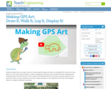
Students design their own logo or picture and use a handheld GPS …
Students design their own logo or picture and use a handheld GPS receiver to map it out. They write out a word or graphic on a field or playground, walk the path, and log GPS data. The results display their "art" on their GPS receiver screen.
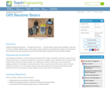
Students familiarize themselves â through trial and error â with the basics …
Students familiarize themselves â through trial and error â with the basics of GPS receiver operation. They view a receiver's satellite visibility screen as they walk in various directions and monitor their progress on the receiver's map. Students may enter waypoints and use the GPS information to guide them back to specific locations.
Students go on a GPS scavenger hunt. They use GPS receivers to …
Students go on a GPS scavenger hunt. They use GPS receivers to find designated waypoints and report back on what they found. They compute distances between waypoints based on the latitude and longitude, and compare with the distance the receiver finds.
During a scavenger hunt and an art project, students learn how to …
During a scavenger hunt and an art project, students learn how to use a handheld GPS receiver for personal navigation. Teachers can request assistance from the Institute of Navigation to find nearby members with experience in using GPS and in locating receivers to use.
« Les organisateurs graphiques suivants peuvent être utilisés à des fins d’enseignement …
« Les organisateurs graphiques suivants peuvent être utilisés à des fins d’enseignement ou d’évaluation. Ils peuvent être téléchargés, adaptés selon vos besoins puis sauvegardés. Des exemples d’utilisation de ces gabarits d’organisateurs graphiques dans le cadre d’une évaluation sont également fournis. »
No restrictions on your remixing, redistributing, or making derivative works. Give credit to the author, as required.
Your remixing, redistributing, or making derivatives works comes with some restrictions, including how it is shared.
Your redistributing comes with some restrictions. Do not remix or make derivative works.
Most restrictive license type. Prohibits most uses, sharing, and any changes.
Copyrighted materials, available under Fair Use and the TEACH Act for US-based educators, or other custom arrangements. Go to the resource provider to see their individual restrictions.