This is a collection of QR Codes that link to resources to …
This is a collection of QR Codes that link to resources to help students meet the required math learning outcomes for Grade 4 Math. These codes could be used as part of playlists for students when working to meet specific outcomes.
This is a collection of QR Codes that link to resources to …
This is a collection of QR Codes that link to resources to help students meet the required math learning outcomes for Grade 3 Math. These codes could be used as part of playlists for students when working to meet specific outcomes.
This is a collection of QR Codes that link to resources to …
This is a collection of QR Codes that link to resources to help students meet the required math learning outcomes for Grade 4 Math. These codes could be used as part of playlists for students when working to meet specific outcomes.
This lesson focuses on students making decisions about what tools to apply …
This lesson focuses on students making decisions about what tools to apply to solve different problems related to quadratic expressions and equations. It is also intended to build awareness of the form an answer will take in order to help students make sense of the kind of problem they are solving. (9th/10th/11th Grade Math)
This question provides students with an opportunity to see expressions as constructed …
This question provides students with an opportunity to see expressions as constructed out of a sequence of operations: first taking the square root of n, then dividing the result of that operation into s. Students studying statistics encounter the expression in this question as the standard deviation of a sampling distribution with samples of size n when the distribution from which the sample is taken has standard deviation s.
In this lesson, students analyze land cover change in order to help …
In this lesson, students analyze land cover change in order to help them grasp the extent, significance, and consequences of land cover change; and to introduce them to the perspective of space-based Earth observations. Students learn to identify kinds of land cover (such as roads, fields, urban areas, and lakes) in Landsat satellite images. They decide which land cover types allow the passage of water into the soil (pervious) and which types do not allow it (impervious). They consider some effects of increasing impervious surface area on ecosystem health. Students then make land cover maps using two Landsat satellite images taken about a decade apart, and quantify the change of land cover from pervious to impervious surface. They also make predictive maps of what they think the nature and extent of land cover change in the area will be in the year 2025, and speculate about the consequences for the availability of water for people and ecosystems. Students justify in writing their predictive maps and their thoughts about the consequences of change. This activity uses Landsat images of Phoenix, Arizona; links are also provided for finding Landsat images of other cities.
Louisianas Highway 1 carries a significant fraction of the gas and oil …
Louisianas Highway 1 carries a significant fraction of the gas and oil that comes from the Gulf of Mexico to distribution points in the United States. Faced with rising seas and sinking land, would the cost of rebuilding the road be worth the investment it required?
Students are introduced to the physical concept of the colors of rainbows …
Students are introduced to the physical concept of the colors of rainbows as light energy in the form of waves with distinct wavelengths, but in a different manner than traditional kaleidoscopes. Looking at different quantum dot solutions, they make observations and measurements, and graph their data. They come to understand how nanoparticles interact with absorbing photons to produce colors. They learn the dependence of particle size and color wavelength and learn about real-world applications for using these colorful liquids.
Students explore the applications of quantum dots by researching a journal article …
Students explore the applications of quantum dots by researching a journal article and answering framing questions used in a classwide discussion. This "Harkness-method" discussion helps students become critical readers of scientific literature.
Expérience scientifique conçue pour les élèves de maternelle - 3e: « Mélangeons! …
Expérience scientifique conçue pour les élèves de maternelle - 3e: « Mélangeons! Que se passe-t-il lorsque vous mélangez différents liquides? Renseignez-vous sur les propriétés des liquides en faisant différents mélanges. »
-Matériel à ramasser -Précautions à prendre -Démarche -Questions pour guider l'observation et la réflexion -Explications -Annexes: autres expériences, leçons connexes et vidéos
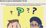
C’est la version de la 5e à la 6e année de cette …
C’est la version de la 5e à la 6e année de cette leçon. KBI offre une variété de leçons sur la gouvernance autochtone pour la 4e à la 9e année, toutes écrites et examinées par des collaborateurs autochtones.
La colonisation Lorsque les Européens sont arrivés sur l'île de la Tortue, ils ont rapidement commencé à la coloniser.
La colonisation de l'île de la Tortue signifiait que les Européens tentaient de contrôler :
Coutumes et langues communautaires Gouvernance Ressources économiques
Le but des colons espagnols, britanniques et français était le même : contrôler le peuple et la terre de l’île de la Tortue.
Cette fiche d’activités porte sur le compte rendu. Tu en apprendras davantage …
Cette fiche d’activités porte sur le compte rendu. Tu en apprendras davantage au sujet des caractéristiques de ce genre de texte et sur ce qu’il faut prendre en compte lorsqu’on en rédige un. Finalement, tu liras un compte rendu et tu répondras à des questions de compréhension.
Directions: Create questions by using one word from the left hand column …
Directions: Create questions by using one word from the left hand column and one word from the top row. The farther down and to the right you go, the more complex and high-level the questions.
This is a lesson about generating hypotheses and testable questions. Learners will …
This is a lesson about generating hypotheses and testable questions. Learners will use critical thinking and a collaborative approach to pose questions related to the study of Mars and evaluate the quality of their questions. They will explore remote-sensing data collected by a camera orbiting Mars - the Thermal Emission Imaging System (THEMIS) and develop a team science question. Students will practice critical thinking skills, use a collaborative approach to this first critical step of the scientific process. Exploring the images of the surface of Mars in Visible (VIS) images, students will come up with a topic of study, their team science question and hypotheses. The lesson models scientific inquiry using the 5E instructional model and includes teacher notes and vocabulary.
After exploring several question and answer books on a variety of topics, …
After exploring several question and answer books on a variety of topics, students research a topic and create their own class question and answer book.
No restrictions on your remixing, redistributing, or making derivative works. Give credit to the author, as required.
Your remixing, redistributing, or making derivatives works comes with some restrictions, including how it is shared.
Your redistributing comes with some restrictions. Do not remix or make derivative works.
Most restrictive license type. Prohibits most uses, sharing, and any changes.
Copyrighted materials, available under Fair Use and the TEACH Act for US-based educators, or other custom arrangements. Go to the resource provider to see their individual restrictions.