You've never seen data presented like this. With the drama and urgency …
You've never seen data presented like this. With the drama and urgency of a sportscaster, statistics guru Hans Rosling debunks myths about the so-called "developing world." A quiz, thought provoking question, and links for further study are provided to create a lesson around the 20-minute video. Educators may use the platform to easily "Flip" or create their own lesson for use with their students of any age or level.
This site offers all kinds of printable worksheets (math, reading, writing), file …
This site offers all kinds of printable worksheets (math, reading, writing), file folder games, coloring pages, mask making templates, and fun facts for kids (animals, geography and weather, bugs, plants, space and solar system, holidays).
An easy to read and understand guide to all things "Canada"! Note: …
An easy to read and understand guide to all things "Canada"! Note: to update, please use "King" instead of Queen. Contents: -The oath -Rights and responsibilities of Canadians -Who are we? -History of Canada -Government of Canada -Elections in Canada -Justice system -Symbols of Canada -Economy -Geography -Websites
Students learn about landslides, discovering that there are different types of landslides …
Students learn about landslides, discovering that there are different types of landslides that occur at different speeds from very slow to very quick. All landslides are the result of gravity, friction and the materials involved. Both natural and human-made factors contribute to landslides. Students learn what makes landslides dangerous and what engineers are doing to prevent and avoid landslides.
This is a lesson about geologic history. Learners will work together to …
This is a lesson about geologic history. Learners will work together to create models of volcanic lava flows and analyze the layers that form on a planet's surface. They will sequence lava flows produced by multiple eruptions. Students will be asked to observe where the flows travel, make a model, and interpret the stratigraphy. Students will use their volcanic layering model to demonstrate the relative dating and geologic mapping principles to later be applied to satellite imagery. The lesson models scientific inquiry using the 5E instructional model and includes teacher notes and vocabulary.
The Residential School story on Google Earth Voyager takes the reader to …
The Residential School story on Google Earth Voyager takes the reader to different locations across Canada that help put this traumatic history in geographical context.
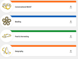
Métis culture will continue to be lived and celebrated when we pass …
Métis culture will continue to be lived and celebrated when we pass our knowledge on to the generations who follow us. Everyone is on a learning journey. While exploring historical and contemporary Métis ways of knowing and doing, these learning packages provide knowledge and understanding for students and teachers. Topics include: Traditional Harvesting Methods, Geographical Terms, Music and Dance, Conversational Michif, Beading, and Traditional Foods. The lesson plans and videos highlight Knowledge Keepers walking in the tall prairie grass, Elders preparing la galette (bannock), students learning Michif numbers, and family greeting each other for tea. We hope these resources will assist you in your learning.
The purpose of NASA's Earth Observatory is to provide a freely accessible …
The purpose of NASA's Earth Observatory is to provide a freely accessible publication on the Internet where the public can obtain new satellite imagery and scientific information about our home planet. The focus is on Earth's climate and environmental change. The site is divided into six main sections: Data and Images, Features, News, Reference, Missions, and Experiments. The Data and Images, Features, and Reference sections are each subdivided into sections for Atmosphere, Oceans, Land, Life on Earth, and Heat and Energy. The missions section explains all of the current NASA missions, and the Experiments section contains activities related to the topics covered in the other sections. Information provided in these pages includes text, photographs, animations, maps, and datasets. The site also includes a glossary, "ask a scientist" feature, and links to current news stories.
The purpose of NASA's Earth Observatory is to provide a freely-accessible publication …
The purpose of NASA's Earth Observatory is to provide a freely-accessible publication on the Internet where the public can obtain new satellite imagery and scientific information about our home planet. The specific focus of this Earth Observatory website is natural hazards. Earth scientists around the world use NASA satellite imagery to better understand the causes and effects of natural hazards. The goal in sharing these images is to help people visualize where and when natural hazards occur, and to help mitigate their effects. Natural hazards that are emphasized include dust and smoke, wildfires, floods, severe storms, and volcanoes. In addition, each week the site highlights major natural hazard events occurring around the globe. Links to satellite imagery and informational text concerning the natural hazard and image interpretation are included. The site also offers a link to unique imagery, such as earthquakes, droughts, and landslides, and features the latest unique imagery events around the globe.
"National Geographic is a trusted resource for all aspects of geographic education. …
"National Geographic is a trusted resource for all aspects of geographic education. This site has resources for grades K-higher education and the breadth of the resources available cover a wide variety of activities, interactive material, mapping (of course), and guides for instructors. The scope of the site is such that subjects such as arts and music, English language arts, and biology are options along with -ology topics that one would expect to find in a site from National Geographic. The indexing of the site by grades, content types, and subjects allow easy searching through the website." (AASL)
Students are introduced to our planet's structure and its dynamic system of …
Students are introduced to our planet's structure and its dynamic system of natural forces through an examination of the natural hazards of earthquakes, volcanoes, landslides, tsunamis, floods and tornados, as well as avalanches, fires, hurricanes and thunderstorms. They see how these natural events become disasters when they impact people, and how engineers help to make people safe from them. Students begin by learning about the structure of the Earth; they create clay models showing the Earth's layers, see a continental drift demo, calculate drift over time, and make fault models. They learn how earthquakes happen; they investigate the integrity of structural designs using model seismographs. Using toothpicks and mini-marshmallows, they create and test structures in a simulated earthquake on a tray of Jell-O. Students learn about the causes, composition and types of volcanoes, and watch and measure a class mock eruption demo, observing the phases that change a mountain's shape. Students learn that the different types of landslides are all are the result of gravity, friction and the materials involved. Using a small-scale model of a debris chute, they explore how landslides start in response to variables in material, slope and water content. Students learn about tsunamis, discovering what causes them and makes them so dangerous. Using a table-top-sized tsunami generator, they test how model structures of different material types fare in devastating waves. Students learn about the causes of floods, their benefits and potential for disaster. Using riverbed models made of clay in baking pans, students simulate the impact of different river volumes, floodplain terrain and levee designs in experimental trials. They learn about the basic characteristics, damage and occurrence of tornadoes, examining them closely by creating water vortices in soda bottles. They complete mock engineering analyses of tornado damage, analyze and graph US tornado damage data, and draw and present structure designs intended to withstand high winds.
Engage middle school students in a meaningful study of the lives of …
Engage middle school students in a meaningful study of the lives of students from across the globe through the use of contemporary nonfiction and fiction. Students create personal autobiographies, sequence story events, and prepare well-crafted summaries while learning to use higher-level comprehension strategies such as Question-Answer Relationships and the Bio-Cube. Additionally, students conduct a critical study of the NCSS Notable Tradebook Nasreen̍s Secret School: A True Story From Afghanistan by Jeanette Winter, comparing and contrasting their own lives to Nasreen̍s and expanding their geographical knowledge of the Middle East.
In this lesson, students analyze land cover change in order to help …
In this lesson, students analyze land cover change in order to help them grasp the extent, significance, and consequences of land cover change; and to introduce them to the perspective of space-based Earth observations. Students learn to identify kinds of land cover (such as roads, fields, urban areas, and lakes) in Landsat satellite images. They decide which land cover types allow the passage of water into the soil (pervious) and which types do not allow it (impervious). They consider some effects of increasing impervious surface area on ecosystem health. Students then make land cover maps using two Landsat satellite images taken about a decade apart, and quantify the change of land cover from pervious to impervious surface. They also make predictive maps of what they think the nature and extent of land cover change in the area will be in the year 2025, and speculate about the consequences for the availability of water for people and ecosystems. Students justify in writing their predictive maps and their thoughts about the consequences of change. This activity uses Landsat images of Phoenix, Arizona; links are also provided for finding Landsat images of other cities.
"People have been eating rice for over 4,000 years. It originated in …
"People have been eating rice for over 4,000 years. It originated in Southeast Asia, and Spanish explorers brought it to the West Indies at least 500 years ago. Today, 8,000 varieties of rice are grown throughout the world. About 15 varieties are grown in the U.S." (Who Belongs Here?: An American Story by Margy Burns Knight) Because we have a strong Southeast Asian student population in the Butler Middle School in Lowell, this unit will focus on Cambodia to drive the question: "What can we learn about rice from the Five Themes of Geography?"Each lesson will revolve around one of the five themes of geography (Location, Place, Region, Movement, and Human Environmental Interaction.) In the sixth lesson, students make cookbooks of rice recipes from Cambodia and other countries from our student population.
This unit presents the earliest history of China, from the Neolithic period …
This unit presents the earliest history of China, from the Neolithic period to the Shang dynasty, in order to introduce students to the development of "state level" (i.e. "civilized") societies.Two lesson plans and three student activities are presented here on-line; the full unit is available in the Primary Source library.Target grades: This unit of study was designed for students in grades four through seven. In several of the lessons, separate activities are provided for grades 4/5 from grades 6/7.Topics: geography, archeology, mythology, oracle bones, Chinese writing.
This worksheet provides a pair of satellite world maps, showing vegetation in …
This worksheet provides a pair of satellite world maps, showing vegetation in January and July, and has a series of questions guiding exploration of the similarities and differences in the two images. The activity is from Space Update, a collection of multimedia educational resources about the Earth and Space. Summary background information, data and images supporting the activity are available on the Earth Update data site.
No restrictions on your remixing, redistributing, or making derivative works. Give credit to the author, as required.
Your remixing, redistributing, or making derivatives works comes with some restrictions, including how it is shared.
Your redistributing comes with some restrictions. Do not remix or make derivative works.
Most restrictive license type. Prohibits most uses, sharing, and any changes.
Copyrighted materials, available under Fair Use and the TEACH Act for US-based educators, or other custom arrangements. Go to the resource provider to see their individual restrictions.